11 Country Roads In Florida That Are Worth Rolling The Windows Down For
Florida has more to offer than theme parks and crowded beaches. Some of the best experiences happen when you take the back roads, where moss drapes from oak trees, salt marshes stretch toward the horizon, and the only traffic is an occasional tractor or heron crossing the asphalt. These drives let you see a slower, quieter side of the state that most visitors miss entirely.
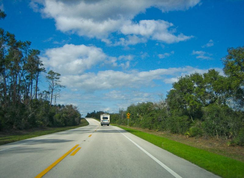
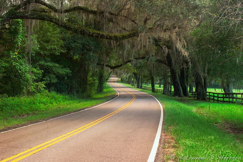
1. Old Florida Heritage Highway (Micanopy, Evinston, Cross Creek)
Rolling through this stretch feels like stepping into a Florida that existed long before the interstates arrived. The pavement winds through prairies dotted with cattle, past weathered barns that lean just enough to tell a story, and alongside small lakes where bald eagles perch in dead pines scanning for fish.
Micanopy itself is worth a slow cruise—brick storefronts, antique shops, and tree-lined streets that haven’t changed much since the 1800s. Evinston and Cross Creek add to the pastoral vibe, with dirt driveways leading to old Cracker homes and hand-painted roadside signs advertising honey or eggs.
Winter is prime time here. Sandhill cranes migrate through by the hundreds, their rattling calls echoing over the fields as they forage in freshly turned soil. Birders pull over constantly, binoculars in hand, scanning fence lines and marshes for species that don’t show up in more developed parts of the state.
The official byway designation highlights CR 325 and CR 346, but plenty of unmarked dirt roads spur off into even quieter territory. You’ll pass horse ranches, oak hammocks, and stretches where the only sound is wind through the palmettos. It’s the kind of drive that makes you forget Florida has millions of people living in it.
2. A1A Scenic & Historic Coastal Byway (St. Augustine to Ponte Vedra Beach)
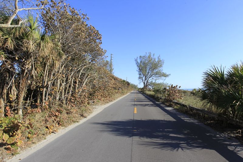
This isn’t farmland country, but it delivers the same windows-down magic with a coastal twist. A1A hugs the Atlantic for 72 miles, dipping in and out of marsh grass, dune scrub, and old beach neighborhoods where the houses still have wooden shutters and crushed-shell driveways.
St. Augustine’s historic district bleeds into quieter stretches where the road narrows and the ocean peeks through gaps in the sea oats. Vilano Beach, Summer Haven, and Ponte Vedra Beach all have their own rhythm—less neon, more salt air and fishing poles leaning against porch railings.
The byway officially earned American Byway status, and it’s easy to see why. Inlets cut through the barrier islands, exposing tidal flats where herons stalk minnows and pelicans dive-bomb schools of mullet. Pull over at any beach access and you’ll find sand that’s not wall-to-wall umbrellas, just families with coolers and kids chasing ghost crabs.
Sunrise drives are unbeatable. The light comes up orange over the water, painting the marshes gold and turning the asphalt into a ribbon of warm gray. Roll the windows down and you’ll get salt, seaweed, and the faint smell of coffee drifting from beach cafes just opening up for the day.
3. Florida Black Bear Scenic Byway (Ocala National Forest)
Deep in the Ocala National Forest, this byway feels more like driving through the Appalachian foothills than central Florida. Longleaf pines tower overhead, their trunks blackened from controlled burns, and the understory is all wiregrass, saw palmetto, and scrubby oaks that barely reach your car window.
The route earned its name honestly—black bears roam these woods in decent numbers, especially near creek bottoms and oak hammocks where acorns pile up in fall. You probably won’t see one from the road, but knowing they’re out there adds a little edge to every curve. Wildlife crossings pop up regularly, reminding you to keep your speed reasonable and your eyes scanning the tree line.
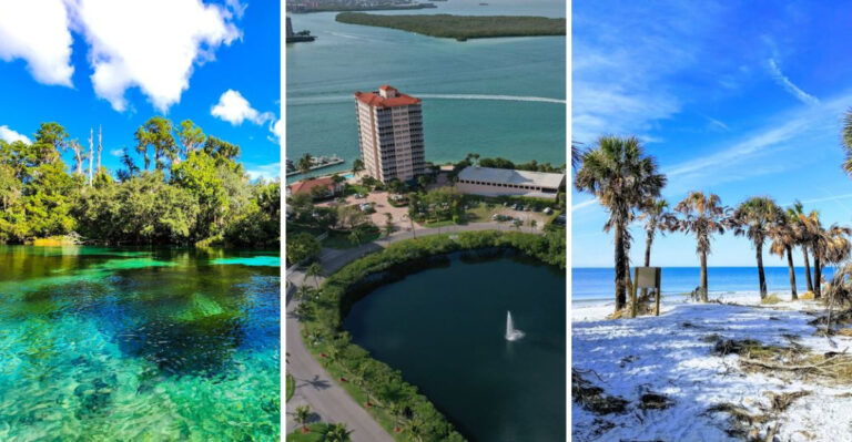
Springs are a big draw here. Alexander Springs, Juniper Springs, and Salt Springs all sit within a short detour of the main route, offering crystal-clear water that stays 72 degrees year-round. Paddlers and swimmers flock to them, but the roads leading in are just as rewarding—shaded, quiet, and lined with cabbage palms and live oaks dripping with Spanish moss.
The forest itself is massive—430,000 acres of public land with camping, hiking, and fishing access scattered throughout. The byway stitches together the best of it, giving you a taste of old Florida wilderness without needing a four-wheel-drive or a machete.
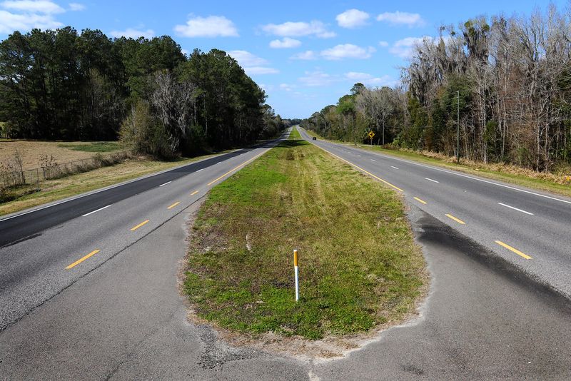
4. Big Bend Scenic Byway (Apalachicola to Tallahassee area)
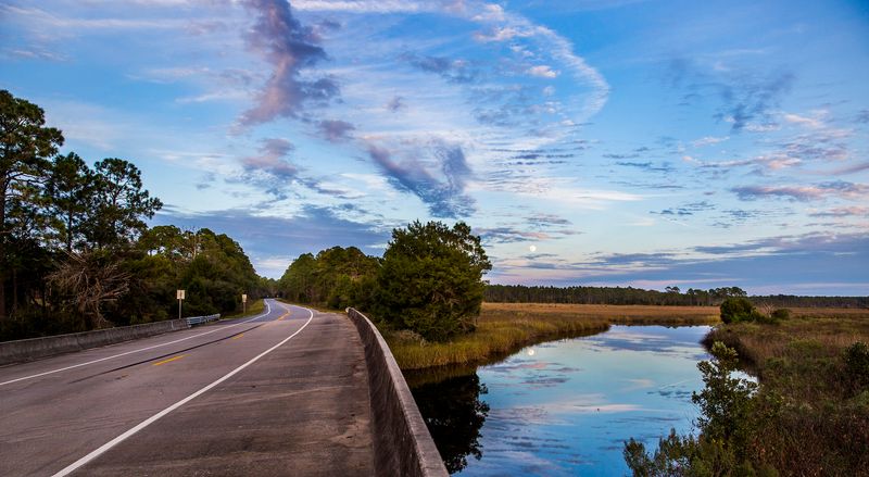
This is the Florida Panhandle at its most remote and beautiful. The Big Bend Scenic Byway stretches about 220 miles through Leon, Wakulla, and Franklin counties, tracing the Gulf Coast where the shoreline curves gently eastward and the beaches give way to endless salt marshes and tidal creeks.
Apalachicola is the heart of the route—a working fishing village where oyster boats still tie up at weathered docks and the downtown streets are lined with tin-roofed buildings that haven’t been gentrified into boutiques yet. Drive west from there and you’ll pass through Carrabelle, Panacea, and St. Marks, each one smaller and quieter than the last.
The scenery shifts constantly. One minute you’re rolling through slash pine forests with palmetto thickets so dense you can’t see ten feet in. The next, the trees open up and you’re staring at a mile-wide expanse of cordgrass and open water, with egrets dotting the flats like white lawn ornaments.
US 98 is the main artery, but the side roads—SR 65, CR 375, and unmarked county spurs—are where the real magic happens. These routes dead-end at boat ramps, fish camps, and tiny coastal communities where the only store sells bait, beer, and sandwiches from a cooler.
5. Heritage Crossroads: Miles of History Scenic Highway (Bradford and Union County area)
Most people blow past Bradford and Union counties on their way to somewhere else, which is exactly why this route feels so untouched. Heritage Crossroads weaves through genuine farm country—cattle operations, hay fields, and small communities where the post office and the feed store are still the social hubs.
The byway follows old travel corridors that predate modern highways by centuries. Indigenous trails, cattle drives, stagecoach tracks, and early auto routes all left their mark here, and some of the back roads still feel like they haven’t been repaved since Eisenhower was president. That’s part of the charm—rough asphalt, faded center lines, and the occasional hand-painted sign pointing toward a church or a cemetery hidden in the pines.
History buffs will find plenty to chew on. The route passes old homesteads, Civil War-era sites, and roadside markers that tell stories about turpentine camps, logging operations, and pioneer settlements. It’s not polished or packaged for tourists—it’s just there, quietly holding onto its past while the rest of Florida rushes forward.
The landscape is pastoral in the best sense: red barns, wire fences, oak-shaded farmhouses, and cows grazing in fields that stretch to the tree line. It’s the kind of drive that makes you want to slow down, roll the windows down, and just breathe in the quiet.
6. Old Brick Road / Dixie Highway Segment (Bunnell area)
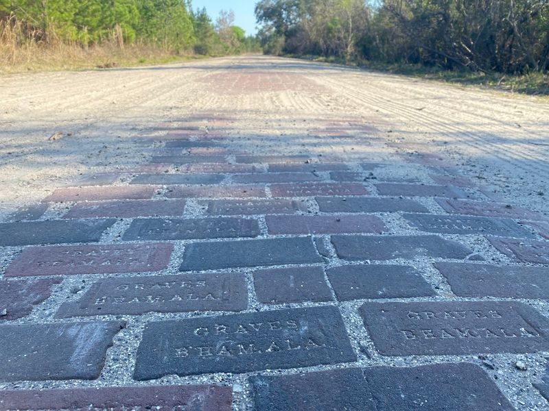
Brick roads aren’t exactly common in Florida anymore, which makes this stretch near Bunnell feel like driving through a time capsule. The pavement—if you can call it that—is made of actual red bricks laid by hand in the 1920s, part of the original Dixie Highway that connected the Midwest to Florida’s growing tourist destinations.
It’s a short segment, just a few blocks, but it’s worth seeking out if you’re a road-history nerd or just curious about what driving felt like a century ago. The bricks are worn smooth in places, cracked and patched in others, and the whole thing rattles your suspension just enough to remind you that modern asphalt is a luxury we take for granted.
The area around the road is quiet—residential streets, old trees, and not much traffic. Bunnell itself is a small town that doesn’t get a lot of tourist attention, which means the brick road isn’t roped off or turned into a museum exhibit. It’s just there, still in use, still doing its job after a hundred years of sun, rain, and tire treads.
This one’s a niche pick, but it fits the “country road” theme in a different way. It’s not about scenery or wildlife—it’s about texture, history, and the weird satisfaction of feeling those bricks thump under your tires as you roll slowly down a street that most people don’t even know exists.
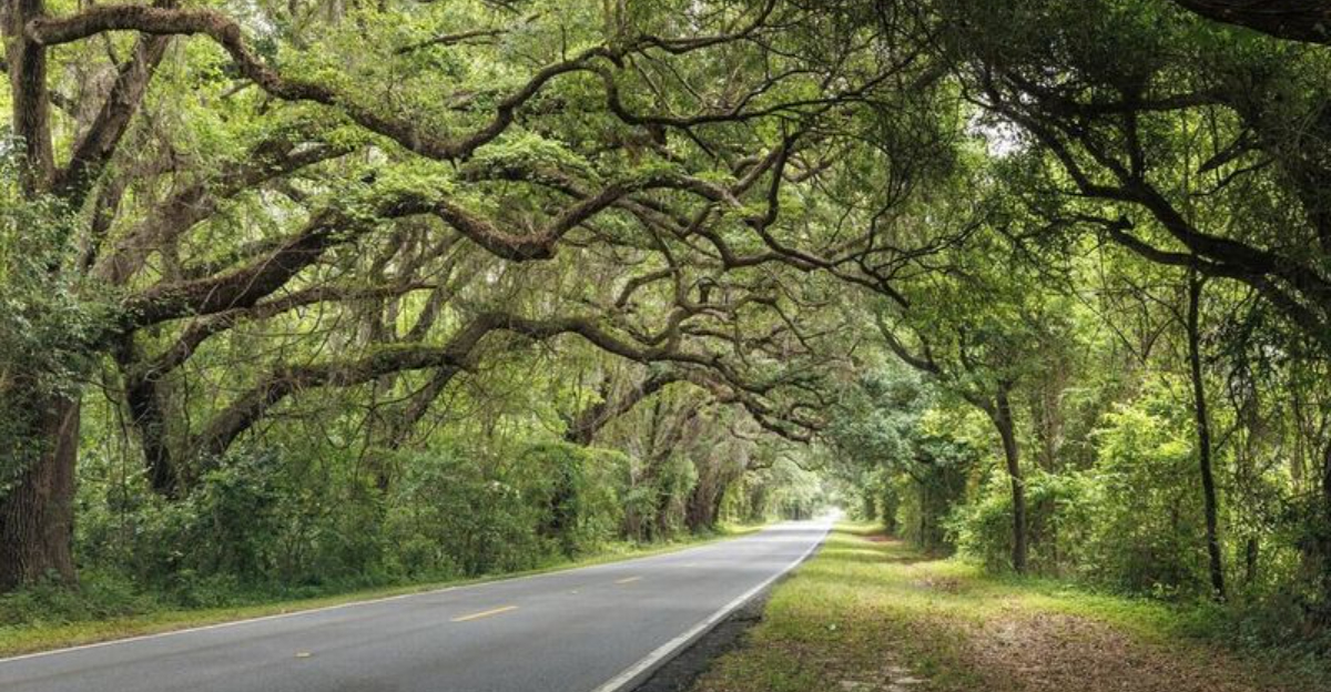
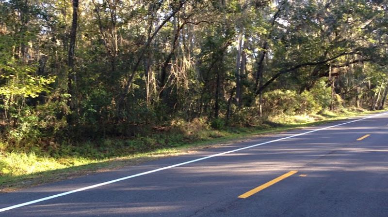
7. Tallahassee Canopy Roads (Tallahassee)
Tallahassee’s canopy roads are the kind of thing that makes you slow down involuntarily. Massive live oaks line both sides of the pavement, their branches arching overhead and meeting in the middle to form a tunnel of leaves and Spanish moss. The effect is dramatic—cool, shaded, almost cathedral-like.
There are five official canopy roads in the area: Old St. Augustine Road, Miccosukee Road, Meridian Road, Old Bainbridge Road, and Centerville Road. Each one has its own character, but they all share that signature oak canopy that locals are fiercely protective of. Development pressure is constant this close to the capital, but preservation efforts have kept these roads mostly intact.
The best time to drive them is late afternoon when the sunlight filters through the leaves and throws dappled shadows across the asphalt. Roll the windows down and you’ll catch the smell of damp earth, leaf mold, and whatever’s blooming in the understory—azaleas in spring, wild grape in summer, tea olive in fall.
These aren’t wilderness roads—they pass through established neighborhoods, past horse farms and old estates with long driveways disappearing into the trees. But the canopy is so thick and the oaks so old that it’s easy to forget you’re in a city. It’s a five-minute vacation without leaving the county limits, and locals use them that way all the time.
8. Ocala Horse Country Backroads (Ocala / Marion County)
Ocala’s horse country looks more like Kentucky than Florida. Rolling pastures stretch out in every direction, bordered by pristine white fences and punctuated by grand live oaks that provide shade for grazing thoroughbreds. The roads wind gently through it all, offering views that shift from open fields to oak-shaded lanes to glimpses of training barns and exercise tracks.
Marion County is one of the top thoroughbred breeding regions in the world, and the landscape reflects that. Farms here aren’t just functional—they’re designed to be beautiful. Mowed grass, trimmed hedges, and horses that look like they stepped out of an oil painting.
Early morning drives are especially rewarding when the mist is still burning off the fields and trainers are leading horses out for their first workouts of the day.
The backroads are the real draw. State Road 200, CR 475, and dozens of unmarked county roads all offer their own version of the same pastoral scene: horses, fences, trees, and sky. There’s no official byway designation here, but Visit Florida calls out Ocala’s horse country specifically as one of the state’s standout scenic driving areas.
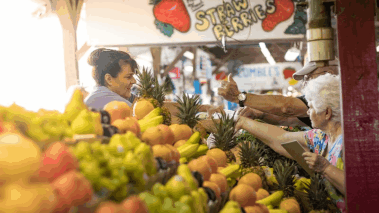
Stop at any farm stand and you’ll find local honey, fresh produce, and people who’ll talk your ear off about bloodlines and racing seasons. It’s a different Florida, one that moves at a slower pace and values tradition over trends.
9. Lemon Bay/Myakka Trail Scenic Highway (Englewood and Charlotte/Sarasota County area)
This is Southwest Florida’s quieter alternative to the crowded beach highways. The Lemon Bay/Myakka Trail Scenic Highway winds through Englewood and the surrounding Charlotte and Sarasota County area, offering a mix of coastal scrub, old Florida communities, bay views, and nature preserves that haven’t been paved over yet.
Englewood itself has managed to stay low-key despite being wedged between Sarasota and Fort Myers. The route passes through neighborhoods where the houses are still one story and the yards are full of palms and sea grapes instead of manicured turf. Lemon Bay stretches out to the west, its shallow waters dotted with mangrove islands and fishing boats moving slowly along marked channels.
The Myakka connection adds inland flavor—oak hammocks, pine flatwoods, and wetlands that flood during summer rains and dry out into cracked mud flats by winter. It’s not dramatic scenery, but it’s authentic, and it gives you a sense of what this part of Florida looked like before the condo towers went up.
Nature preserves and boat ramps pop up regularly along the route, offering easy access to hiking trails, kayak launches, and fishing spots that locals use constantly. It’s a good drive for people who want Gulf Coast scenery without the traffic jams and beachfront commercialism that define most of the region.
10. William Bartram Scenic & Historic Highway / SR 13 (St. Johns River area)
State Road 13 follows the St. Johns River through a stretch of Northeast Florida that feels more Old South than modern suburb. The William Bartram Scenic & Historic Highway designation honors the 18th-century naturalist who explored this region and documented its plants, animals, and Indigenous peoples in vivid detail.
The river is the star here—wide, slow-moving, and lined with cypress trees and water oaks that lean out over the current. Moss hangs heavy from the branches, and the whole scene has a timeless quality that makes you think about steamboats and trading posts instead of strip malls and traffic lights.
The route passes through small river towns with names like Mandarin, Switzerland, and Fruit Cove—places that predate Jacksonville’s sprawl and still retain some of their original character. Historic markers dot the roadside, pointing out old homesteads, ferry crossings, and sites where Bartram himself camped and sketched.
It’s a better windows-down drive than most people expect from the Jacksonville area. The river views alone are worth the trip, but the side roads and spur routes add layers—state parks, boat ramps, fish camps, and quiet neighborhoods where the houses face the water and the yards slope down to private docks. It’s a slower, quieter side of a region that’s usually all about military bases and beach traffic.
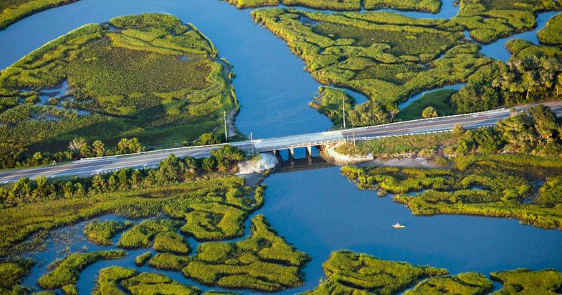
11. Indian River Lagoon National Scenic Byway (Space Coast / Treasure Coast)
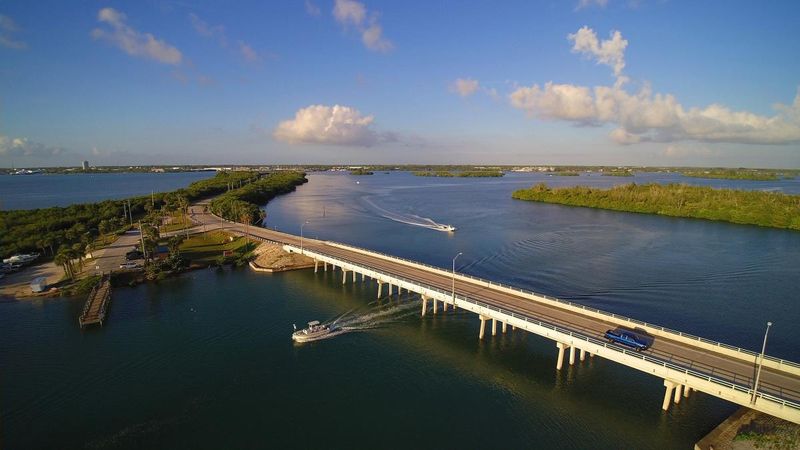
The Indian River Lagoon isn’t technically a river—it’s a long, shallow estuary that runs parallel to the Atlantic coast for over 150 miles. The byway that follows it offers a laid-back coastal-lagoon experience with river views, wildlife areas, old fishing-town vibes, and plenty of spots to pull over and just watch the water.
The route covers both the Space Coast and Treasure Coast, passing through towns like Titusville, Cocoa, Melbourne, Sebastian, and Vero Beach. Each one has its own personality, but they all share that same waterfront character—marinas, seafood shacks, bait shops, and parks where locals fish off seawalls and watch dolphins cruise by.
Wildlife is a constant presence. Manatees gather in the lagoon during winter, seeking out warm-water refuges near power plants and natural springs. Pelicans, herons, ibises, and roseate spoonbills work the shallows, and ospreys nest on channel markers and utility poles.
It’s one of the most biodiverse estuaries in North America, and you don’t need binoculars or a guide to see evidence of that—just roll down the windows and pay attention.
The byway offers a softer, more local alternative to the busier beach highways. It’s less about surf and suntan oil, more about tidal flats, mullet jumping, and the kind of quiet coastal scenery that makes you want to find a picnic table and just sit for a while.