Think You’re Brave? Try Driving Across These 9 Florida Bridges
One bridge on this list has concrete dolphins guarding its feet, and not a single one can swim. They’re giant protective blocks built to keep wandering ships from bumping the bridge’s piers.
Another crossing climbs so high that the road tilts you toward the clouds over open water. A different one in the Keys stretches nearly seven miles, with no exit and no easy place to change your mind halfway.
I love that Florida, a state famous for being pancake flat, hides this many white-knuckle drives over water. Some are scary because of height, some because of sheer length, and one earns its reputation mostly through bumper-to-bumper traffic.
1. Bob Graham Sunshine Skyway Bridge
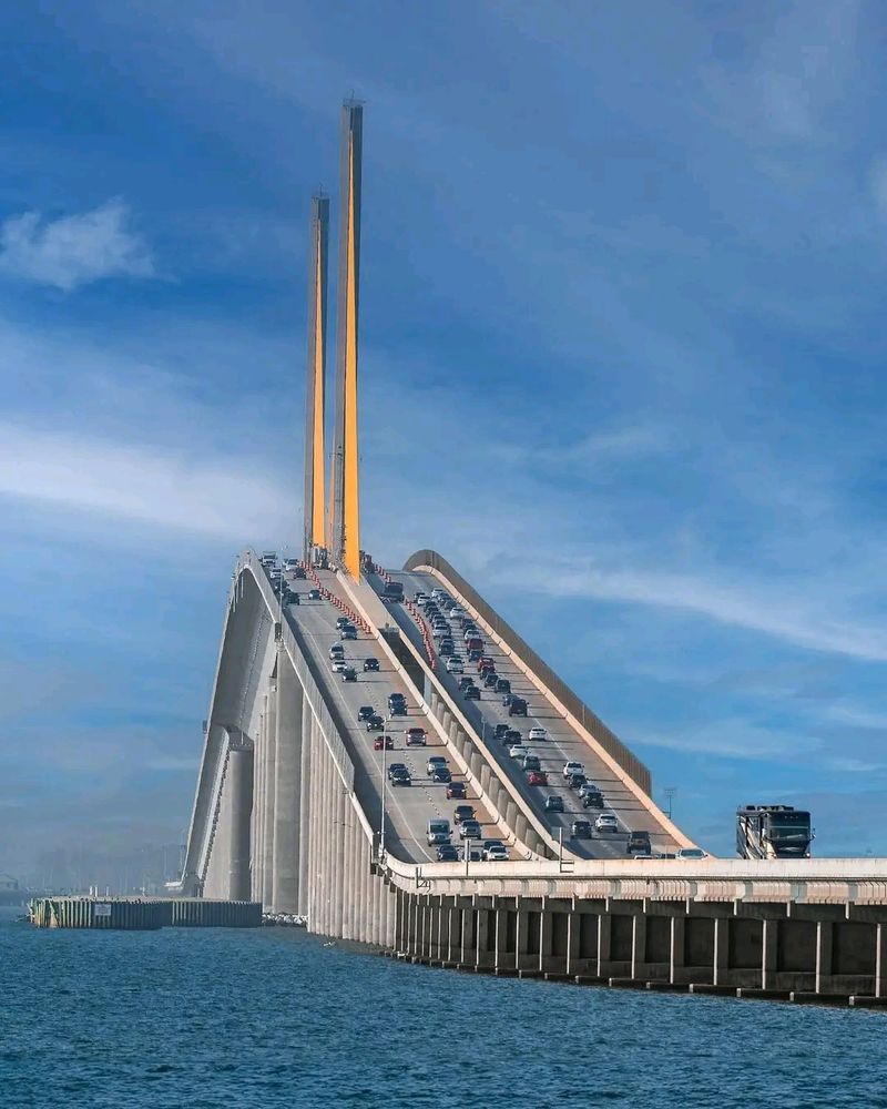
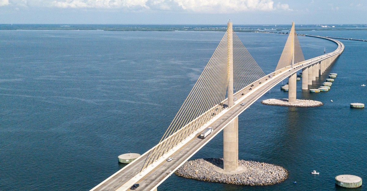
Bright yellow cables make this bridge look like a giant harp tuned for seagulls. At its peak, the structure rises about 430 feet, making it the tallest bridge in Florida.
The drive climbs steadily over Tampa Bay, and the view keeps widening as you go. You’ll see water stretching toward the Gulf, so passengers get the best seats in the car.
Drivers, meanwhile, should keep their eyes on the road and their hands relaxed. The span runs roughly four miles over the water, which feels longer when the wind picks up.
History adds weight to this crossing. In 1980, a ship struck the older bridge here, part of it fell into the bay, and 35 people lost their lives.
The current cable-stayed bridge opened in 1987 as its replacement. In 2005, it was renamed to honor Bob Graham, a former Florida governor and U.S. senator.
Pieces of the old bridge didn’t simply vanish, either. Parts became fishing piers that now belong to Skyway Fishing Pier State Park, found at both ends of the crossing.
Morning and evening light can make those yellow cables look even brighter. That glow may pull your eyes off the road, so hand the camera to a passenger.
Expect a toll on this route, and plan your payment before you arrive. Fumbling with payment while your nerves are buzzing is nobody’s idea of fun.
So what’s the smartest move if heights make your palms sweat? Stay in your lane, keep a steady speed, and let someone else handle the sightseeing.
Want a calmer way to enjoy it first? Visit the fishing pier and admire those cables from below before tackling the climb.
Address: 7508-7534 Sunshine Skyway Ln S, St. Petersburg, FL 33711
2. Seven Mile Bridge
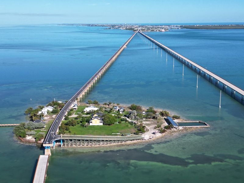
Once you roll onto this bridge, the next stretch of solid ground is a long way off. The span runs close to seven miles across open water in the Florida Keys.
It’s part of the Overseas Highway, better known as US 1. That makes it one of the most famous links in the island chain between Marathon and the Lower Keys.
Brave drivers love it because the views are huge. Nervous drivers sweat because there are no exits and no easy way to turn around once you commit.
The current bridge opened in 1982. Right beside it, you’ll spot an older bridge that started life as part of Henry Flagler’s railroad, built back in 1912.
That old structure isn’t for cars anymore. It has been renovated as a path for walkers and cyclists heading to Pigeon Key, a small island with its own slice of railroad history.
Seeing the two bridges side by side is a neat history lesson at highway speed. One shows how the Keys connected a century ago, and the other shows how you get there today.
Thinking about pulling over for a photo mid-bridge? Don’t, since the drive is built for steady travel rather than roadside stops.
Instead, fill your tank before you start and snap your photos from land in Marathon. Water on both sides can feel endless, so a calm playlist might help.
Wind is the other thing to watch. Higher sections can catch gusts, so keep both hands on the wheel and give larger vehicles some room.
It’s a bucket-list drive for good reason. Seven miles never felt so short and so long at the same time.
Address: Overseas Highway (US 1), Marathon to Little Duck Key, Florida Keys
3. Card Sound Bridge
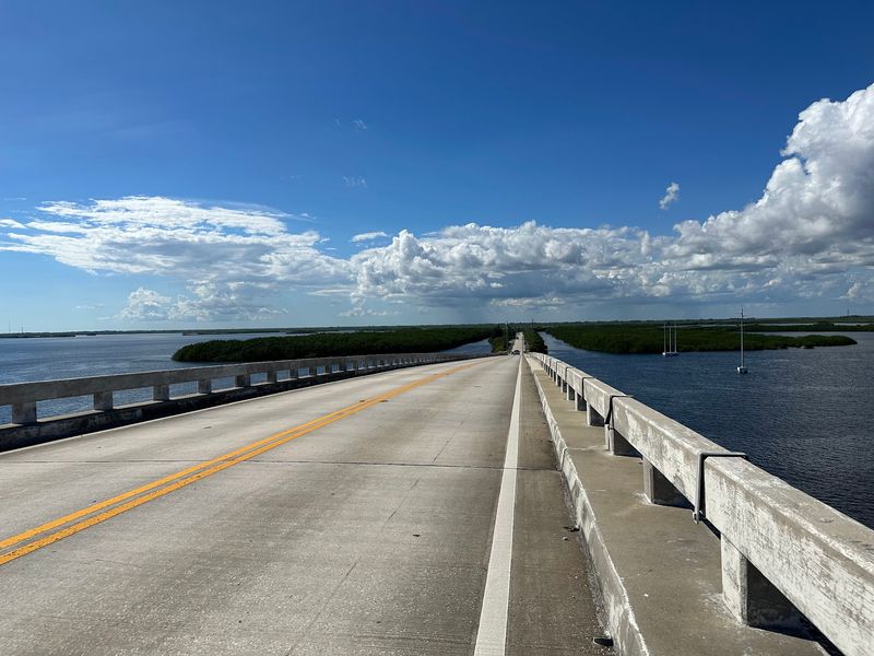
Prefer your scary drives with a side of quiet? This toll bridge sits on one of only two road routes into the Florida Keys, and it skips the main highway crowd.
The bridge climbs to about 65 feet above the water. That’s enough height to give you a wide look at the surrounding water and shoreline.
Its length is around 2,800 feet, so the crossing itself goes by quickly. The real thrill comes from the isolated feel of Card Sound Road leading up to it.
Most Keys traffic sticks to US 1, also called the Overseas Highway. This road gives you a different path between the mainland near Florida City and North Key Largo.
That isolation is part of the appeal and part of the challenge. It’s smart to top off your gas and snacks before you leave the mainland.
Be ready to pay the toll as well. Checking the current payment options before your trip saves you a headache at the booth.
The bridge has been carrying drivers for more than fifty years. In that time, it has stayed a handy alternative to the main highway.
Why choose it at all? Some travelers simply like a quieter drive, and the high rise gives a nice moment of open-water drama.
Keep your speed sensible on the approach roads. Cyclists and slower vehicles may share these remote stretches, so a relaxed pace is the brave and smart choice.
Think of it as the scenic side door to the Keys. It’s shorter than the big-name bridges, yet it still delivers a little rush at the top.
Address: Card Sound Road, Florida City to North Key Largo, FL
4. Howard Frankland Bridge
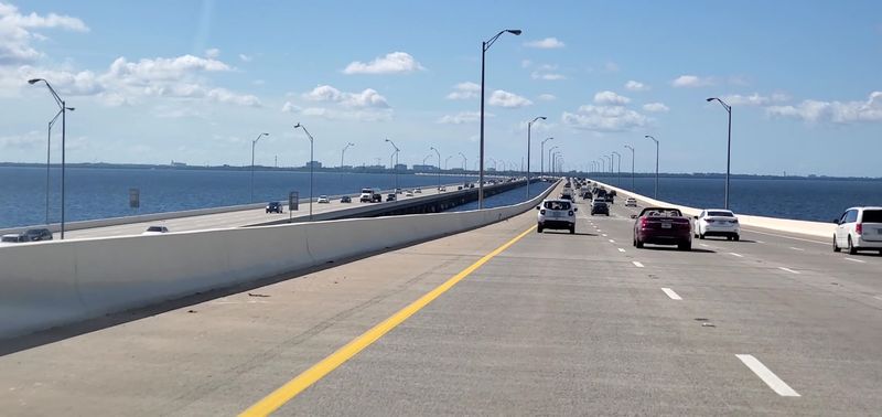
Height isn’t the scary part here. Traffic is, with roughly 177,000 vehicles crossing this Interstate 275 bridge on a typical day.
The bridge stretches across Old Tampa Bay between Tampa and St. Petersburg. It ranks among the busiest bridge crossings in Florida, so calm nerves come in handy.
Locals have given it a pile of unflattering nicknames over the decades. The most famous is probably ‘Howard Frankenstein,’ which tells you plenty about the mood behind the wheel.
So why include a fairly flat bridge on a bravery list? Because merging at rush hour with a wall of cars beside you can test anyone’s patience.
The water sits close on both sides, which adds to the boxed-in feeling. During hurricane season, the bridge gets even more stressful as storms bring wind and rain.
Your best strategy is simple planning. Check traffic before you leave, and try to avoid peak commute hours when possible.
Pick your lane early and stay there. Last-second swerves are the fastest way to turn a busy crossing into a frantic one.
Keep a safe following distance, too. Sudden slowdowns happen on heavily traveled roads, and a little space gives you time to react.
Views of the bay are still there if you look for them. Passengers get the best of it while drivers focus on brake lights.
A podcast or audiobook can make a slow crawl feel shorter. Just keep the volume low enough to hear what’s happening around you.
Weekend trips can feel different from weekday ones. Even so, a crash or breakdown can back things up at almost any hour.
Bravery comes in many forms, and this one is the commuter kind. Conquer it at five o’clock and you’ve earned bragging rights for the week.
Address: I-275, Tampa to St. Petersburg, FL
5. Dames Point Bridge
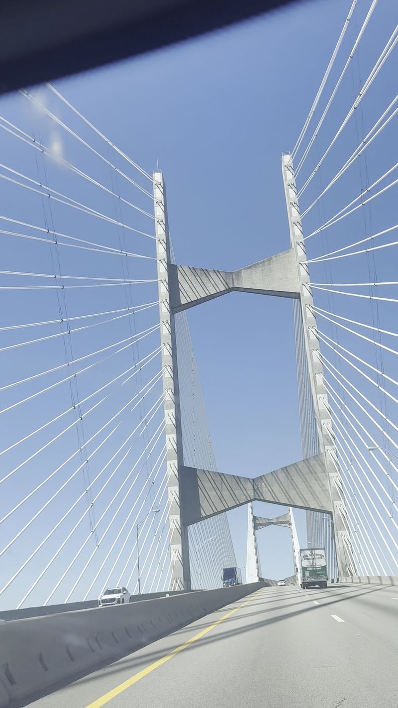
Giant concrete ‘dolphins’ guard the base of this bridge’s piers, and they’re not the kind that do flips. They’re protective structures built to shield the bridge from ships on the St. Johns River.
Officially, the bridge is named the Napoleon Bonaparte Broward Bridge. It’s commonly known as Dames Point, which is much easier to say in traffic.
The cable-stayed design looks sleek, with cables fanning out from tall towers. Up top, the roadway sits about 175 feet above the water.
That clearance puts it among only two bridges in Florida with more than 170 feet of room below. Yes, that’s high enough to make your stomach do a quick hop.
Some drivers reportedly choose other routes just to skip it. If that sounds like you, you’re definitely not alone.
The bridge opened in 1989. In March 2025, the National Transportation Safety Board recommended evaluating it for risk from vessel strikes.
That recommendation came because the bridge was built before 1991 safety guidance for those assessments. It covered a number of older bridges, not just this one.
Jacksonville has plenty of bridges, but few look this dramatic against the sky. The tall towers make it easy to spot from far away.
Ready to try it anyway? Keep your eyes forward, since looking down at the river while climbing won’t help your nerves.
Wind can feel stronger at this height, so steady hands matter. Trucks can also block your view, so leave extra room.
Passengers should grab the window seat on a clear day. The height turns the drive into a quick, free sightseeing tour of the river and port below.
Address: Jacksonville, FL (spans St. Johns River)
6. Venetian Causeway
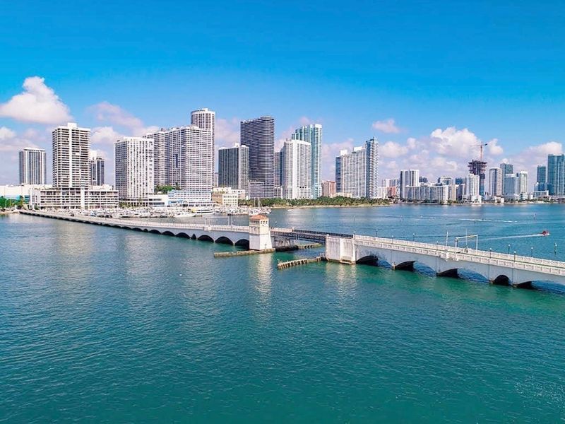
Nearly a century old, this route proves a bridge doesn’t need to be tall to make you sweat. The original causeway was built in 1927 across Biscayne Bay.
It links Miami and Miami Beach through a chain of small islands. Along the way, you’ll cross bascule bridges, which are drawbridges that lift for boats.
The challenge is the tight squeeze. Some sections feel narrow, and some drivers find the lanes cramped compared with bigger highways.
You’ll share the route with two-way traffic and plenty of company outside your car. It’s a popular path for runners, so watch for people on foot.
Slow and steady fits this route best. A relaxed pace gives you time to spot pedestrians and react to drawbridge signals.
Drawbridges add their own twist. When a span goes up, you wait, so build a little extra time into your plans.
The causeway has been renovated several times over the years. More improvement work has been in the planning stages, so check for construction updates before you go.
So what’s the payoff? You get close-up views of the bay and the islands, a nice change from zooming along a big interstate.
History buffs will enjoy knowing they’re driving a route from the 1920s. That old-school charm comes with old-school width, which is part of the adventure.
Size isn’t the only factor on a bravery list. A short bridge with tight lanes can raise your heart rate as fast as a giant one.
Photos from the islands can look like a postcard. Just make sure you’re parked legally before you reach for your phone.
Brave here means calm, careful, and patient. Florida drivers who master this one can handle just about any tight spot.
Address: Miami to Miami Beach, FL (across Biscayne Bay)
7. John’s Pass Bridge
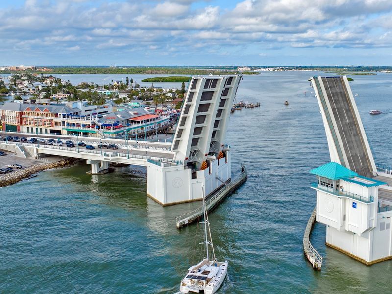
A hurricane carved out this inlet back in 1848, and the water still hasn’t calmed down. Swift currents rush through John’s Pass, which shapes how the bridge above it works.
The drawbridge connects Treasure Island and Madeira Beach. Many area drawbridges open on a schedule, but this one opens on demand because of those powerful currents.
For boaters, that’s a safety win. For drivers, it can mean a surprise wait while the span lifts and boats pass through.
The current twin spans are fairly new. The southbound side opened in 2010, and the northbound side followed in 2011.
When the bridge is closed, it offers about 27 feet of vertical clearance. Boats that need more room trigger an opening, so busy boating days can bring more stops.
Why does it belong on a bravery list? It’s less about height and more about patience, timing, and keeping your cool near a busy beach area.
Right next to the bridge sits John’s Pass Village and Boardwalk, a bustling tourist spot. Pedestrians, shoppers, and drivers mix here, so stay alert.
Got time to spare? Park and explore the boardwalk, then watch the bridge rise from a safer spot on foot.
The busy inlet below makes for fun boat-spotting while you wait. Consider it a free show with a front-row seat.
If you’re driving through, leave a cushion in your schedule. A quick hop between beach towns can stretch longer when the gates come down.
Keep an eye on warning lights and gates as you approach. Stopping smoothly beats racing a rising roadway.
Kids in the back seat may actually cheer when the bridge goes up. Grown-ups running late tend to feel differently.
Address: 12754 Kingfish Dr, Treasure Island, FL 33706
8. Garcon Point Bridge
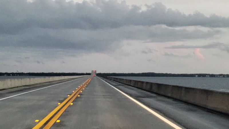
Before it was built, this project earned the nickname ‘Bo’s Bridge.’ Today it’s a two-lane toll bridge stretching about 3.5 miles across East Bay in Santa Rosa County.
Officially, the length is 18,425 feet. That’s a long time to spend over water with only one lane heading your way.
The bridge rises to a 65-foot vertical clearance. It was built with precast concrete segments, a method that pieces the structure together like giant building blocks.
It opened on May 14, 1999. The route links US 98 on the Fairpoint Peninsula with Avalon Boulevard, which leads toward Interstate 10 and US 90 near Milton.
On a normal day, traffic is often light. That quiet can feel peaceful or a little eerie, depending on your nerves.
Things changed in 2020 during Hurricane Sally. After the Pensacola Bay Bridge was damaged, this crossing became the main alternate route, and tolls were suspended for several months.
That stretch showed how important a backup bridge can be. Suddenly, a quiet toll road was carrying far more drivers than usual.
Two lanes mean there’s no room for careless passing. Stay patient behind slower vehicles, and keep your attention locked on the road ahead.
Serious crashes have happened here, which is a good reminder to slow down. Avoid distractions and save the scenery for your passengers.
Long, low stretches can lull you into zoning out. A quick stretch and snack before crossing can keep you sharp.
Paying the toll is part of the deal on regular days. Check the payment options ahead of time so there are no surprises.
For Panhandle drivers, this bridge is a handy shortcut toward the interstate. For visitors, it’s a sneaky-long test of focus.
Address: 555 Avalon Boulevard, Milton, FL 32571
9. General Daniel “Chappie” James Jr. Bridge
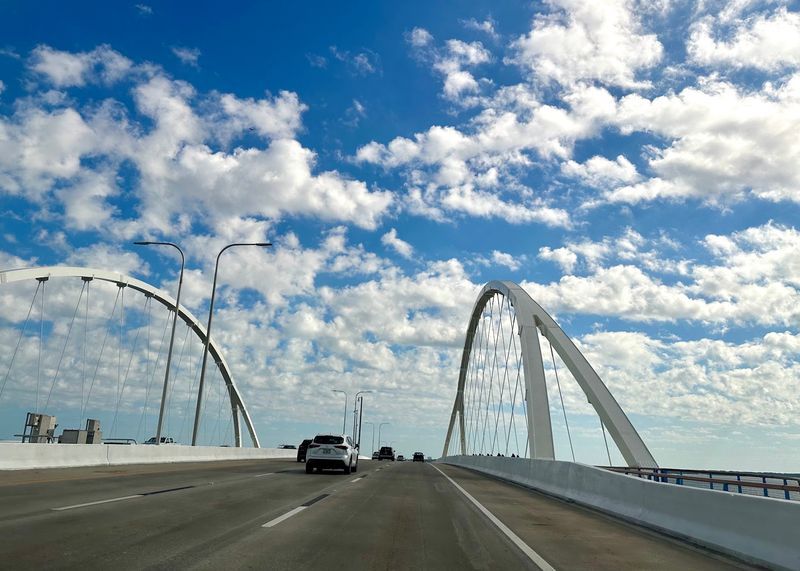
Few bridges have a comeback story like this one. In September 2020, during Hurricane Sally, construction equipment struck the bridge and a span collapsed, closing it for eight months.
Locals know it as the Pensacola Bay Bridge or the Three-Mile Bridge. It carries six lanes of US 98 between downtown Pensacola and Gulf Breeze.
The crossing measures 16,140 feet, or roughly three miles. It offers 65 feet of clearance for boats passing underneath.
The current bridge arrived in two pieces. The eastbound span opened on September 5, 2019, and the westbound span followed on February 14, 2023.
In June 2020, it was renamed for General Daniel ‘Chappie’ James Jr. He was a Pensacola native and the first African American four-star general in the U.S. Air Force.
That’s a proud name to carry across the bay. It turns an ordinary commute into a quick lesson in hometown history.
Modern upgrades make the drive more comfortable than you might expect. You’ll find emergency lanes, updated barrier walls, and newer lighting along the route.
Six lanes give drivers more breathing room than many older bridges. That extra space can make nervous drivers feel a bit braver.
Still, three miles over open water can test anyone who gets uneasy over wide bays. Gusty days add a little extra excitement to the ride.
The bridge also matters far beyond daily trips. It has long served as a key evacuation route for the Florida Panhandle.
Want a smoother crossing? Pick your lane early, keep a steady speed, and let your passengers enjoy the bay views toward Gulf Breeze.
Finish this one and you’ve earned your bravery badge. Florida’s bridges may test your nerves, but they sure know how to deliver a view.
Address: US 98, Pensacola to Gulf Breeze, FL